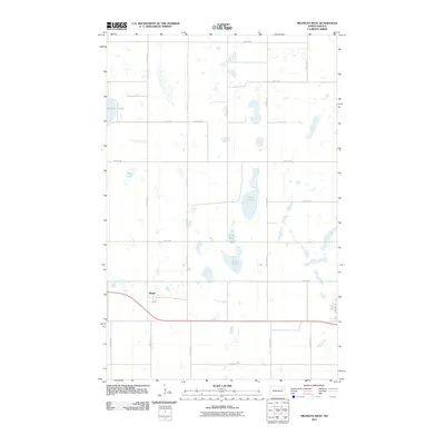
2011 Map of Michigan West
USGS Topo · Published 2011About this map
Mapes sits as a primary point of reference in this Nelson County landscape, positioned along the east-west transit corridor that defines the southern half of the quadrangle. The surrounding terrain is characterized by the prairie pothole geography typical of the region, featuring significant water bodies such as Lake Laretta, Lake Mary, and Rose Lake. These lakes, along with McHugh Slough and Fiske Lake, create a fragmented surface of water and wetland that has historically influenced the placement of roads and farmsteads. The section-line grid is well-established by routes like 111th Ave NE and 47th St NE, showing a landscape deeply committed to agricultural development while navigating the numerous natural basins of the Dakotas.
Find a feature on this map
23 named features on this map. Tap any name to fly to it.
Don’t see what you’re looking for? This feature index may not catch every label — zoom into the map to look around manually.
Map Details
Editions of this 2011 Michigan West Map
This is the sole edition of this map. No revisions or reprints were ever made.
Other maps of this area

1930 · Pekin
USGS Topo · 1:62,500

1942 · McVille
USGS Topo · 1:62,500

1951 · Pekin NE
USGS Topo · 1:24,000

1951 · Pekin
USGS Topo · 1:62,500

1952 · New Rockford
USGS Topo · 1:250,000

1953 · Devils Lake
USGS Topo · 1:250,000

1956 · New Rockford
USGS Topo · 1:250,000

1956 · Devils Lake
USGS Topo · 1:250,000

1970 · Lakota
USGS Topo · 1:24,000

1971 · Michigan West
USGS Topo · 1:24,000