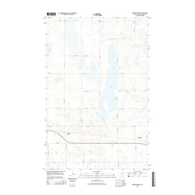
2014 Map of Michigan West
USGS Topo · Published 2014About this map
Michigan and Mapes anchor the southern portion of this Nelson County landscape, where the prairie begins to break into a complex network of glacial wetlands and depressions. The town of Michigan sits at the junction of Us-2 and Inez Ave, serving as a primary local hub for the surrounding agricultural grid. To the west, the smaller settlement of Mapes lies along the same vital transit corridor, which runs parallel to a lattice of section roads like 42nd St NE.
Find a feature on this map
24 named features on this map. Tap any name to fly to it.
Don’t see what you’re looking for? This feature index may not catch every label — zoom into the map to look around manually.
Map Details
Editions of this 2014 Michigan West Map
This is the sole edition of this map. No revisions or reprints were ever made.
Other maps of this area

1930 · Pekin
USGS Topo · 1:62,500

1942 · McVille
USGS Topo · 1:62,500

1951 · Pekin NE
USGS Topo · 1:24,000

1951 · Pekin
USGS Topo · 1:62,500

1952 · New Rockford
USGS Topo · 1:250,000

1953 · Devils Lake
USGS Topo · 1:250,000

1956 · New Rockford
USGS Topo · 1:250,000

1956 · Devils Lake
USGS Topo · 1:250,000

1970 · Lakota
USGS Topo · 1:24,000

1971 · Michigan West
USGS Topo · 1:24,000