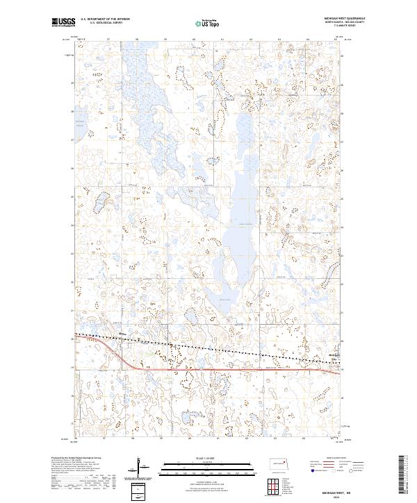
2024 Map of Michigan West
USGS Topo · Published 2024About this map
Michigan City and the small settlement of Mapes anchor this section of Nelson County, where the agricultural grid meets a complex prairie pothole landscape. The terrain is defined by numerous water bodies and wetlands, most notably Lake Laretta, Rose Lake, and McHugh Slough, which provide vital habitat within the Nelson County Waterfowl Production Area. The section lines are strictly maintained by a network of rural roads such as 42nd St NE and Co Rd 22, illustrating the intersection of systematic land division and the irregular natural hydrology of the North Dakota plains. This geography suggests a region where land use is a careful balance between productive farming and protected conservation zones intended for migratory birds.
Find a feature on this map
28 named features on this map. Tap any name to fly to it.
Don’t see what you’re looking for? This feature index may not catch every label — zoom into the map to look around manually.
Map Details
Editions of this 2024 Michigan West Map
This is the sole edition of this map. No revisions or reprints were ever made.
Other maps of this area

1930 · Pekin
USGS Topo · 1:62,500

1942 · McVille
USGS Topo · 1:62,500

1951 · Pekin NE
USGS Topo · 1:24,000

1951 · Pekin
USGS Topo · 1:62,500

1952 · New Rockford
USGS Topo · 1:250,000

1953 · Devils Lake
USGS Topo · 1:250,000

1956 · New Rockford
USGS Topo · 1:250,000

1956 · Devils Lake
USGS Topo · 1:250,000

1970 · Lakota
USGS Topo · 1:24,000

1971 · Michigan West
USGS Topo · 1:24,000