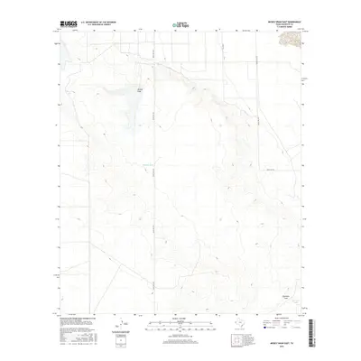
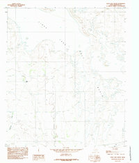
2016 Map of Mickey Draw East
USGS Topo · Published 2016About this map
Mickey Draw and Eightmile Draw define the drainage patterns of this Hudspeth County landscape, where the ephemeral water courses and man-made reservoirs like Melbeth Tank and Eightmile Tank illustrate the necessity of water management in the Trans-Pecos region. The terrain is traversed by remote transit corridors including Ranch Rd 1437 and Ranch Rd 1576, which connect the scattered ranching interests of the West Texas interior. This topographic study, produced with data from the 2014 NAIP imagery and the National Hydrography Dataset, serves as a record of the modern ranching infrastructure. Features such as Gallegos provide specific points of interest for those documenting the rural development and land use of the High Desert during the early twenty-first century.
Find a feature on this map
7 named features on this map. Tap any name to fly to it.
Don’t see what you’re looking for? This feature index may not catch every label — zoom into the map to look around manually.
Map Details
Editions of this 2016 Mickey Draw East Map
This is the sole edition of this map. No revisions or reprints were ever made.
Other maps of this area

1951 · Dell City
USGS Topo · 1:62,500

1951 · Red Hills
USGS Topo · 1:62,500

1954 · Van Horn
USGS Topo · 1:250,000

1955 · Cerro Diablo
USGS Topo · 1:62,500

1955 · Black Mountains
USGS Topo · 1:62,500

1958 · Van Horn
USGS Topo · 1:250,000
1984 · Dell City
USGS Topo · 1:24,000
1984 · Mickey Draw West
USGS Topo · 1:24,000
1984 · Black Mountains NW
USGS Topo · 1:24,000
1984 · Linda Lake South
USGS Topo · 1:24,000