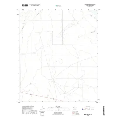
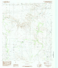
2019 Map of Mickey Draw West
USGS Topo · Published 2019About this map
Mickey Draw and Hitson Draw define the drainage patterns of this arid Hudspeth County landscape, carving subtle paths through the high Chihuahuan Desert terrain. This 2019 survey reflects a sparsely populated ranching region where infrastructure is limited to a few critical arteries and unimproved tracks. The presence of Foster Ranch Rd and Ranch Verde Rd underscores the enduring ranching heritage of the area, providing access across the broad, open basins typical of West Texas. Near the southern edge of the sheet, the alignment of FM 1111 serves as a primary connector through the scrubland. This map is particularly useful for those studying contemporary land use and the persistent desert hydrology that dictates the movement of water and livestock in this corner of the state.
Find a feature on this map
5 named features on this map. Tap any name to fly to it.
Don’t see what you’re looking for? This feature index may not catch every label — zoom into the map to look around manually.
Map Details
Editions of this 2019 Mickey Draw West Map
This is the sole edition of this map. No revisions or reprints were ever made.
Other maps of this area

1951 · Dell City
USGS Topo · 1:62,500

1951 · Red Hills
USGS Topo · 1:62,500

1954 · Van Horn
USGS Topo · 1:250,000

1955 · Cerro Diablo
USGS Topo · 1:62,500

1955 · Black Mountains
USGS Topo · 1:62,500

1958 · Van Horn
USGS Topo · 1:250,000
1984 · Dell City
USGS Topo · 1:24,000
1984 · Mickey Draw West
USGS Topo · 1:24,000
1984 · Cerro Diablo
USGS Topo · 1:24,000
1984 · Black Mountains NW
USGS Topo · 1:24,000