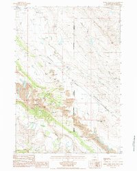
1984 Map of Middle Creek Butte
USGS Topo · Published 1984About this map
Middle Creek Butte dominates the southeastern quadrant of this landscape, rising above the confluence of numerous drainages along the border of Wyoming and South Dakota. The mid-1980s terrain is heavily defined by industrial activity, with several dozen Claypit and Disturbed Areas concentrated along the northern banks of the Belle Fourche River. This mining activity is supported by a network of infrastructure including a Wooden Pole Trans Line, a Pipeline, and the Chicago and North Western railroad, which cuts northwest through the center of the sheet.
Find a feature on this map
22 named features on this map. Tap any name to fly to it.
Don’t see what you’re looking for? This feature index may not catch every label — zoom into the map to look around manually.
Map Details
Editions of this 1984 Middle Creek Butte Map
This is the sole edition of this map. No revisions or reprints were ever made.
Other maps of this area

1901 · Aladdin
USGS Topo · 1:125,000

1903 · Aladdin
USGS Topo · 1:125,000

1905 · Indian
USGS Topo · 1:62,500

1907 · Belle Fourche
USGS Topo · 1:125,000

1907 · Redwater
USGS Topo · 1:62,500

1953 · Rapid City
USGS Topo · 1:250,000

1954 · The Forks
USGS Topo · 1:24,000

1954 · Gillette
USGS Topo · 1:250,000

1955 · Gillette
USGS Topo · 1:250,000

1957 · Rapid City
USGS Topo · 1:250,000