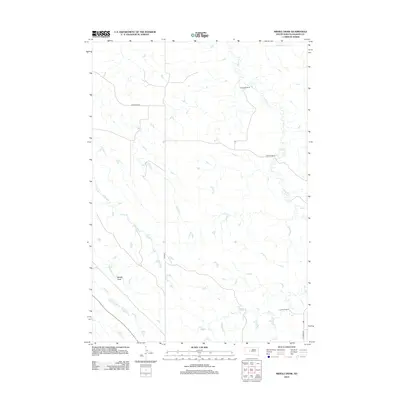
2012 Map of Middle Draw
USGS Topo · Published 2012About this map
Middle Draw defines this portion of the Haakon County high plains, where the land is carved by a dendritic network of intermittent drainages. The topography is shaped by seasonal watercourses like Crooked Cr in the north and the winding path of Plum Cr, which cuts across the eastern half of the quadrangle. Ranching footprints are evident at the Schofield Ranch in the northeast, reflecting the enduring agricultural character of this rural South Dakota landscape. Transportation is confined to a sparse grid of section-line roads, including Singleton Rd and Quinn Rd, which provide access through the open terrain between Long Br and Shanty Cr. In the southeast corner, Ottumwa Rd runs near the confluence of local tributaries into Deer Cr, marking one of the few improved routes in this expansive cattle country.
Find a feature on this map
10 named features on this map. Tap any name to fly to it.
Don’t see what you’re looking for? This feature index may not catch every label — zoom into the map to look around manually.
Map Details
Editions of this 2012 Middle Draw Map
This is the sole edition of this map. No revisions or reprints were ever made.
Other maps of this area

1954 · Pierre
USGS Topo · 1:250,000

1955 · Rattlesnake Lake SE
USGS Topo · 1:24,000

1956 · Kirley
USGS Topo · 1:24,000

1956 · Cherry Creek
USGS Topo · 1:24,000

1958 · Pierre
USGS Topo · 1:250,000

1983 · Mule Creek
USGS Topo · 1:24,000

1983 · Philip
USGS Topo · 1:100,000

1983 · Moenville
USGS Topo · 1:24,000

1983 · Middle Draw
USGS Topo · 1:24,000

1983 · Tornado Ranch
USGS Topo · 1:24,000