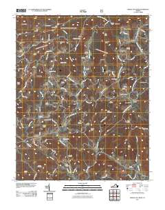
2011 Map of Middle Fox Creek
USGS Topo · Published 2011About this map
Barton Crossroad serves as a central point in this corner of Grayson County, where a dense network of family cemeteries speaks to generations of settlement. Names like the Old Parks Cemetery, Burton Chapel Cemetery, and Holdaway Cemetery are scattered across the high ridges and hollows, providing essential data for genealogical research. The landscape is defined by the headwaters of Middle Fox Creek and various branches of Elk Creek, which carve deep valleys between high points such as Kindrick Mountain and Fries Knob. Local roads like Rabbit Fork Rd and Honey Grove Rd follow the natural contours of the terrain, connecting isolated homesteads to the wider region. High gaps, including Houndshell Gap and Blue Spring Gap, indicate historic transit routes through the Blue Ridge foothills.
Find a feature on this map
93 named features on this map. Tap any name to fly to it.
Don’t see what you’re looking for? This feature index may not catch every label — zoom into the map to look around manually.
Map Details
Editions of this 2011 Middle Fox Creek Map
This is the sole edition of this map. No revisions or reprints were ever made.
Other maps of this area

1889 · Wytheville
USGS Topo · 1:125,000

1892 · Wytheville
USGS Topo · 1:125,000

1930 · Speedwell
USGS Topo · 1:62,500

1930 · Independence
USGS Topo · 1:48,000

1931 · Rural Retreat
USGS Topo · 1:48,000

1933 · Independence
USGS Topo · 1:62,500

1935 · Mouth of Wilson
USGS Topo · 1:48,000

1935 · Cedar Springs
USGS Topo · 1:24,000
1935 · Trout Dale
USGS Topo · 1:24,000
1935 · Atkins
USGS Topo · 1:24,000