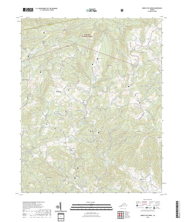
2022 Map of Middle Fox Creek
USGS Topo · Published 2022About this map
Flat Ridge sits at the center of this mountain landscape, marking a community defined by its proximity to the Tennessee Valley Divide. Within the boundaries of the Jefferson National Forest, the map reveals a dense network of family cemeteries and local worship sites that point to generations of upland settlement. Significant genealogy markers include the Burton Chapel Cem, Riley Preston Parks Cem, and Holdaway Cem, which are scattered across the ridges and narrow valleys.
Find a feature on this map
134 named features on this map. Tap any name to fly to it.
Don’t see what you’re looking for? This feature index may not catch every label — zoom into the map to look around manually.
Map Details
Editions of this 2022 Middle Fox Creek Map
This is the sole edition of this map. No revisions or reprints were ever made.
Other maps of this area

1889 · Wytheville
USGS Topo · 1:125,000

1892 · Wytheville
USGS Topo · 1:125,000

1930 · Speedwell
USGS Topo · 1:62,500

1930 · Independence
USGS Topo · 1:48,000

1931 · Rural Retreat
USGS Topo · 1:48,000

1933 · Independence
USGS Topo · 1:62,500

1935 · Mouth of Wilson
USGS Topo · 1:48,000

1935 · Cedar Springs
USGS Topo · 1:24,000
1935 · Trout Dale
USGS Topo · 1:24,000
1935 · Atkins
USGS Topo · 1:24,000