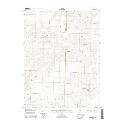
2014 Map of Middle Grove
USGS Topo · Published 2014About this map
Middle Grove and Evansville anchor this rural landscape along the boundary of Randolph and Monroe counties. The terrain is defined by the winding course of the Elk Fork Salt River, which creates a network of drainages including Coon Creek and Flat Creek. Smaller settlements like Milton are situated near several named water bodies such as Johnson Lake, Mallory Lake, and Anderson Lake, which suggests a history of local water management for agricultural or recreational use in this central Missouri region.
Find a feature on this map
69 named features on this map. Tap any name to fly to it.
Don’t see what you’re looking for? This feature index may not catch every label — zoom into the map to look around manually.
Map Details
Editions of this 2014 Middle Grove Map
This is the sole edition of this map. No revisions or reprints were ever made.
Other maps of this area

1890 · Moberly
USGS Topo · 1:125,000

1908 · Macon
USGS Topo · 1:62,500

1910 · Macon
USGS Topo · 1:62,500

1952 · Middle Grove
USGS Topo · 1:24,000

1953 · Moberly
USGS Topo · 1:250,000

1953 · Renick
USGS Topo · 1:24,000

1953 · Clark
USGS Topo · 1:24,000
1953 · Moberly
USGS Topo · 1:24,000

1954 · Moberly
USGS Topo · 1:250,000

1957 · Moberly
USGS Topo · 1:250,000