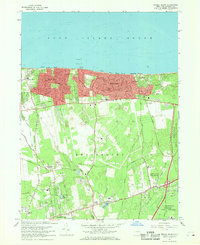
1967 Map of Middle Island
USGS Topo · Published 1969About this map
Sound Beach and Rocky Point anchor the northern coastline of this Suffolk County survey, where residential development clusters near the cliffs of the Long Island Sound. Moving inland, the landscape shifts toward the sprawling U S Reservation Brookhaven National Laboratory and the Middle Island State Game Farm, reflecting the post-war transition of central Long Island from agricultural use to institutional and scientific footprints.
Find a feature on this map
46 named features on this map. Tap any name to fly to it.
Don’t see what you’re looking for? This feature index may not catch every label — zoom into the map to look around manually.
Map Details
Editions of this 1967 Middle Island Map
This is the sole edition of this map. No revisions or reprints were ever made.
Other maps of this area

1891 · Bridgeport
USGS Topo · 1:62,500

1893 · Bridgeport
USGS Topo · 1:62,500

1902 · Setauket
USGS Topo · 1:62,500

1904 · Setauket
USGS Topo · 1:62,500

1904 · Islip
USGS Topo · 1:125,000

1904 · Moriches
USGS Topo · 1:62,500

1919 · Setauket
USGS Topo · 1:62,500

1920 · Bridgeport
USGS Topo · 1:62,500

1942 · Islip
USGS Topo · 1:125,000

1947 · Bellport
USGS Topo · 1:24,000