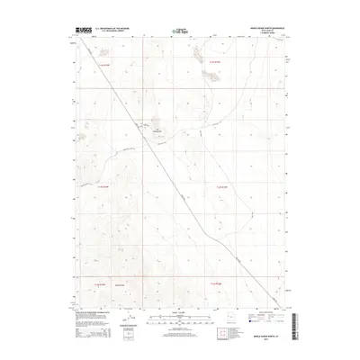
2014 Map of Middle Range North
USGS Topo · Published 2014About this map
Honey Comb Mine and the distinctive geological formation known as The Honeycombs define this arid landscape in Juab County. This 2014 survey documents a remote stretch of the Great Basin, where the southern portion of the sheet is dominated by the northern extent of the Middle Range. The transportation network consists of a few primary desert arteries, including the diagonal path of Weiss Hwy and the specialized Race Trak to the east. These roads, along with the Partoun Cut-Off Rd, reveal a terrain shaped by mineral extraction and recreational land use rather than permanent settlement. The topographical data provides clear insight into the drainage patterns and ridge lines that characterize this high-desert environment.
Find a feature on this map
13 named features on this map. Tap any name to fly to it.
Don’t see what you’re looking for? This feature index may not catch every label — zoom into the map to look around manually.
Map Details
Editions of this 2014 Middle Range North Map
This is the sole edition of this map. No revisions or reprints were ever made.
Other maps of this area

1908 · Fish Springs
USGS Topo · 1:250,000

1910 · Fish Springs
USGS Topo · 1:250,000

1953 · Delta
USGS Topo · 1:250,000

1958 · Delta
USGS Topo · 1:250,000

1960 · Granite Mountain
USGS Topo · 1:62,500

1962 · Delta
USGS Topo · 1:250,000

1967 · Sand Pass
USGS Topo · 1:24,000

1967 · Sand Pass NW
USGS Topo · 1:24,000
1967 · Fish Springs SW
USGS Topo · 1:24,000

1972 · Mud Lake Reservoir
USGS Topo · 1:24,000