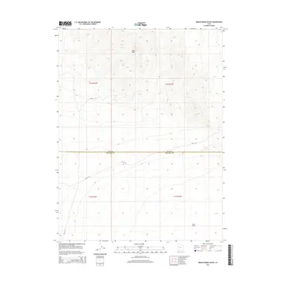
2014 Map of Middle Range South
USGS Topo · Published 2014About this map
The Middle Range mountains dominate the northern landscape of this 2014 survey, rising above the western edge of Tule Valley. This high-desert terrain is marked by the jurisdictional boundary between Juab and Millard counties, which cuts horizontally across the map. The area is characterized by its isolation and limited infrastructure, primarily defined by the primitive Well 58 Rd and the Backfire Trl. These routes suggest a landscape managed for fire control and minimal access, typical of the Great Basin’s vast public lands. The detailed topography illustrates the steep drainage patterns of the range as they descend toward the valley floor, providing a clear record of the area's physical geography before any modern developments altered these traditional desert pathways.
Find a feature on this map
9 named features on this map. Tap any name to fly to it.
Don’t see what you’re looking for? This feature index may not catch every label — zoom into the map to look around manually.
Map Details
Editions of this 2014 Middle Range South Map
This is the sole edition of this map. No revisions or reprints were ever made.
Other maps of this area

1908 · Fish Springs
USGS Topo · 1:250,000

1910 · Fish Springs
USGS Topo · 1:250,000

1953 · Delta
USGS Topo · 1:250,000

1958 · Delta
USGS Topo · 1:250,000

1959 · Cowboy Pass
USGS Topo · 1:62,500

1960 · Granite Mountain
USGS Topo · 1:62,500

1962 · Delta
USGS Topo · 1:250,000

1967 · Sand Pass
USGS Topo · 1:24,000

1967 · Sand Pass NW
USGS Topo · 1:24,000
1972 · Swasey Peak NW
USGS Topo · 1:24,000