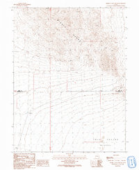
1991 Map of Middle Range South
USGS Topo · Published 1991About this map
Middle Range dominates the northern half of this terrain, transitioning into the expansive Tule Valley to the south. This 1991 provisional survey captures a desert landscape defined by severe topographic relief and seasonal water sources. The transition from the high peaks of the range down into the low-lying (Depression) of the valley floor reveals a classic Basin and Range geological profile. Human activity is sparse, marked primarily by industrial and surveying markers. A Mine is located among the northern ridges, while evidence of water management and early navigation appears through a lonely Well and several benchmark locations like Bm 4853. The sheet also documents the jurisdictional boundary where Juab Co meets Millard Co, crossing the valley floor alongside primitive 4wd tracks that represent the only infrastructure in this arid corridor.
Find a feature on this map
10 named features on this map. Tap any name to fly to it.
Don’t see what you’re looking for? This feature index may not catch every label — zoom into the map to look around manually.
Map Details
Editions of this 1991 Middle Range South Map
This is the sole edition of this map. No revisions or reprints were ever made.
Other maps of this area

1908 · Fish Springs
USGS Topo · 1:250,000

1910 · Fish Springs
USGS Topo · 1:250,000

1953 · Delta
USGS Topo · 1:250,000

1958 · Delta
USGS Topo · 1:250,000

1959 · Cowboy Pass
USGS Topo · 1:62,500

1960 · Granite Mountain
USGS Topo · 1:62,500

1962 · Delta
USGS Topo · 1:250,000

1967 · Sand Pass
USGS Topo · 1:24,000

1967 · Sand Pass NW
USGS Topo · 1:24,000
1972 · Swasey Peak NW
USGS Topo · 1:24,000