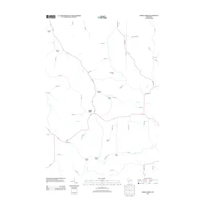
2013 Map of Middle Ridge
USGS Topo · Published 2013About this map
Middle Ridge sits atop the high ground between the headwaters of the Mississippi River's tributaries in this 2013 survey. The landscape is defined by the Driftless Area's characteristic topography, where deep valleys known locally as coulees—including Russian Coulee, Bedessem Coulee, and Darling Coulee—carve into the limestone plateau. This settlement pattern follows the ridges and valley floors, with Wi-162 and Wi-33 serving as the primary arteries connecting small hubs like Newberg Corners. The drainage network is particularly visible here, as Dutch Cr, Fish Cr, and Bostwick Cr radiate from the central divide of Fish Creek Ridge. Researchers will find numerous family-named landmarks such as Bunker Hill and Korn Coulee that reflect the agricultural heritage of this Monroe County upland, where roads like Korn Clements Rd and Jernander Rd trace the paths of early homesteads.
Find a feature on this map
50 named features on this map. Tap any name to fly to it.
Don’t see what you’re looking for? This feature index may not catch every label — zoom into the map to look around manually.
Map Details
Editions of this 2013 Middle Ridge Map
This is the sole edition of this map. No revisions or reprints were ever made.
Other maps of this area

1909 · Sparta
USGS Topo · 1:62,500

1923 · Viroqua
USGS Topo · 1:62,500

1926 · Stoddard
USGS Topo · 1:62,500

1926 · Viroqua
USGS Topo · 1:62,500

1927 · La Crosse
USGS Topo · 1:62,500

1930 · La Crosse
USGS Topo · 1:62,500

1947 · Sparta
USGS Topo · 1:62,500

1949 · Sparta
USGS Topo · 1:62,500

1958 · La Crosse
USGS Topo · 1:250,000

1961 · La Crosse
USGS Topo · 1:250,000