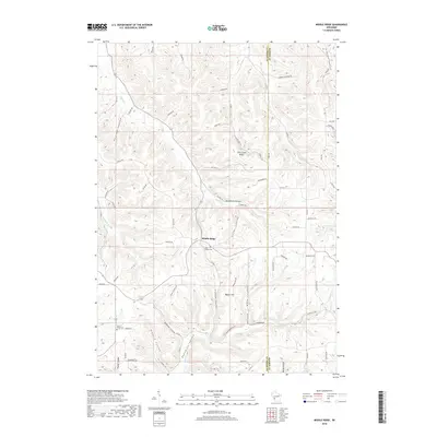
2018 Map of Middle Ridge
USGS Topo · Published 2018About this map
Middle Ridge sits at the heart of a complex network of coulees and ridges along the border of La Crosse and Monroe counties. This part of the Driftless Area is defined by its deep, narrow valleys, known locally as coulees, such as Darling Coulee and Poplar Coulee. The settlement pattern follows these contours, with historic cemeteries like Saint Peter's Cem and North Ridge Cem serving as landmarks for the rural community. The map reveals how the steep terrain has dictated local movement, with roads winding through Bohemian Valley and along high ground like Fish Creek Ridge. The intricate drainage system, including Dutch Cr and Coon Cr, illustrates the erosion-carved landscape that characterizes this region of Wisconsin. These geographic features reflect generations of agricultural adaptation to the unique topography of southwestern Wisconsin.
Find a feature on this map
55 named features on this map. Tap any name to fly to it.
Don’t see what you’re looking for? This feature index may not catch every label — zoom into the map to look around manually.
Map Details
Editions of this 2018 Middle Ridge Map
This is the sole edition of this map. No revisions or reprints were ever made.
Other maps of this area

1909 · Sparta
USGS Topo · 1:62,500

1923 · Viroqua
USGS Topo · 1:62,500

1926 · Stoddard
USGS Topo · 1:62,500

1926 · Viroqua
USGS Topo · 1:62,500

1927 · La Crosse
USGS Topo · 1:62,500

1930 · La Crosse
USGS Topo · 1:62,500

1947 · Sparta
USGS Topo · 1:62,500

1949 · Sparta
USGS Topo · 1:62,500

1958 · La Crosse
USGS Topo · 1:250,000

1961 · La Crosse
USGS Topo · 1:250,000