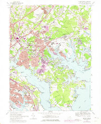
1969 Map of Middle River
USGS Topo · Published 1975About this map
The suburban and industrial expansion of Baltimore County is evident in this late 1960s study, where residential developments like Victory Villa and Aero Acres sit alongside critical transportation hubs. The landscape is dominated by the sprawling Martin Airport and the coastal reach of Middle River, with newer infrastructure like the Baltimore Beltway and Kennedy Memorial Highway slicing through older settlements.
Find a feature on this map
106 named features on this map. Tap any name to fly to it.
Don’t see what you’re looking for? This feature index may not catch every label — zoom into the map to look around manually.
Map Details
Editions of this 1969 Middle River Map
4 editions found
Other maps of this area

1893 · North Point
USGS Topo · 1:62,500

1893 · Gunpowder
USGS Topo · 1:62,500

1894 · Baltimore
USGS Topo · 1:62,500

1894 · Relay
USGS Topo · 1:62,500

1898 · Tolchester
USGS Topo · 1:125,000

1899 · Baltimore
USGS Topo · 1:62,500

1901 · Gunpowder
USGS Topo · 1:62,500

1903 · Tolchester
USGS Topo · 1:125,000

1904 · Baltimore
USGS Topo · 1:62,500

1904 · North Point
USGS Topo · 1:62,500