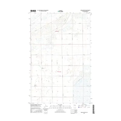
2016 Map of Middle River NE
USGS Topo · Published 2016About this map
Middle River winds through the southwestern corner of this Marshall County landscape, where the flat terrain is defined by a grid of agricultural roads and extensive wetlands. The region reflects the traditional land division of the Public Land Survey System, with township lines like t158n r42w and t157n r42w partitioning the prairie. Local heritage is centered around small rural gathering places, notably the Riverside Cem near the riverbanks and the Evangelical Cem further south along 360th St NE. To the southeast, the Tamarack Pool and the headwaters of the Thief River signal a transition into more saturated marshlands, illustrating the complex hydrology of northern Minnesota's peatlands and drainage basins.
Find a feature on this map
25 named features on this map. Tap any name to fly to it.
Don’t see what you’re looking for? This feature index may not catch every label — zoom into the map to look around manually.
Map Details
Editions of this 2016 Middle River NE Map
This is the sole edition of this map. No revisions or reprints were ever made.
Other maps of this area

1918 · Rollis
USGS Topo · 1:62,500

1918 · Garland
USGS Topo · 1:62,500

1918 · Greenbush
USGS Topo · 1:62,500

1918 · Middle River
USGS Topo · 1:62,500

1943 · Rollis
USGS Topo · 1:62,500

1952 · Thief River Falls
USGS Topo · 1:250,000

1954 · Roseau
USGS Topo · 1:250,000

1956 · Thief River Falls
USGS Topo · 1:250,000

1957 · Roseau
USGS Topo · 1:250,000

1957 · Thief River Falls
USGS Topo · 1:250,000