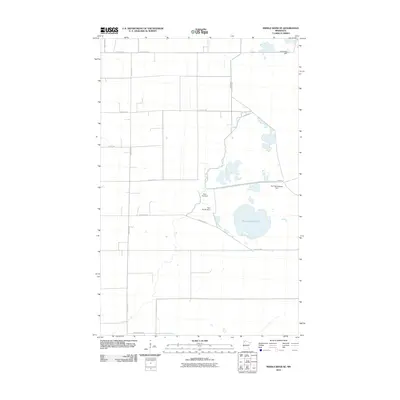
2010 Map of Middle River SE
USGS Topo · Published 2010About this map
The Agassiz region of Marshall County defines this landscape, where the flat terrain of the former glacial lake bed is managed through an intricate series of water control structures. The Thief River winds through the eastern portion of the sheet, feeding into a network of managed water bodies such as the prominent Green Stump Pool. This 2010 survey illustrates a highly engineered environment designed for drainage and water management, featuring several named dams including Pool Ten Dam, Pool Eleven Dam, and Pool Twentyseven Dam. A rigid grid of section-line roads, including 170th Ave NE and 320th St NE, provides access to the surrounding agricultural lands and wildlife management areas, while County Hwy-7 serves as a primary east-west corridor through the marshy lowland.
Find a feature on this map
17 named features on this map. Tap any name to fly to it.
Don’t see what you’re looking for? This feature index may not catch every label — zoom into the map to look around manually.
Map Details
Editions of this 2010 Middle River SE Map
This is the sole edition of this map. No revisions or reprints were ever made.
Other maps of this area

1918 · Rollis
USGS Topo · 1:62,500

1918 · Middle River
USGS Topo · 1:62,500

1943 · Rollis
USGS Topo · 1:62,500

1943 · Thief River Falls
USGS Topo · 1:62,500

1952 · Thief River Falls
USGS Topo · 1:250,000

1954 · Roseau
USGS Topo · 1:250,000

1956 · Thief River Falls
USGS Topo · 1:250,000

1957 · Roseau
USGS Topo · 1:250,000

1957 · Thief River Falls
USGS Topo · 1:250,000

1958 · Roseau
USGS Topo · 1:250,000