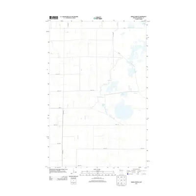
2013 Map of Middle River SE
USGS Topo · Published 2013About this map
Thief River winds through this low-lying wetland landscape in Marshall County, defined by the intricate water management systems of the Agassiz region. The map reveals a complex network of artificial and natural water bodies, including the Madsen Reservoir and Lansing Parker Reservoir, which serve as critical nodes in the local hydrology. This area is characterized by vast expanses of pools such as Agassiz Pool, Northwest Pool, and Thief Bay Pool, illustrating the transition of the Red River Valley’s eastern edge into managed marshlands. A rigid grid of section roads, including Co Hwy-7 and 300th St NE, provides access through the saturated terrain, connecting remote drainage points and water control structures like Green Stump Pool and Mud Lake.
Find a feature on this map
18 named features on this map. Tap any name to fly to it.
Don’t see what you’re looking for? This feature index may not catch every label — zoom into the map to look around manually.
Map Details
Editions of this 2013 Middle River SE Map
This is the sole edition of this map. No revisions or reprints were ever made.
Other maps of this area

1918 · Rollis
USGS Topo · 1:62,500

1918 · Middle River
USGS Topo · 1:62,500

1943 · Rollis
USGS Topo · 1:62,500

1943 · Thief River Falls
USGS Topo · 1:62,500

1952 · Thief River Falls
USGS Topo · 1:250,000

1954 · Roseau
USGS Topo · 1:250,000

1956 · Thief River Falls
USGS Topo · 1:250,000

1957 · Roseau
USGS Topo · 1:250,000

1957 · Thief River Falls
USGS Topo · 1:250,000

1958 · Roseau
USGS Topo · 1:250,000