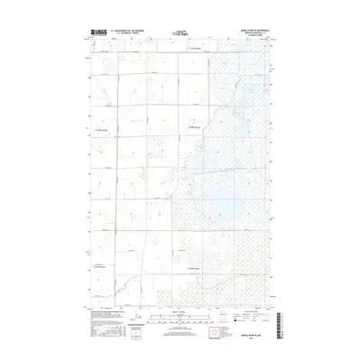
2016 Map of Middle River SE
USGS Topo · Published 2016About this map
The Agassiz Pool and its complex network of managed wetlands dominate this landscape in Marshall County. This region is defined by an intricate system of pools and reservoirs, including the Northwest Pool, Madsen Pool, and the Green Stump Pool. These water bodies are connected by a grid of rural roads such as CO Hwy 7 and local routes like 330th St NE, which cut across the low-lying terrain. The presence of the Lansing Parker Reservoir and Madsen Reservoir suggests a heavily managed hydraulic environment, likely supporting wildlife conservation or agricultural irrigation. Farther south, the Rodahl Trail and the winding course of the Thief River provide a contrast to the geometric precision of the township and range survey lines that dictate the local road network.
Find a feature on this map
27 named features on this map. Tap any name to fly to it.
Don’t see what you’re looking for? This feature index may not catch every label — zoom into the map to look around manually.
Map Details
Editions of this 2016 Middle River SE Map
This is the sole edition of this map. No revisions or reprints were ever made.
Other maps of this area

1918 · Rollis
USGS Topo · 1:62,500

1918 · Middle River
USGS Topo · 1:62,500

1943 · Rollis
USGS Topo · 1:62,500

1943 · Thief River Falls
USGS Topo · 1:62,500

1952 · Thief River Falls
USGS Topo · 1:250,000

1954 · Roseau
USGS Topo · 1:250,000

1956 · Thief River Falls
USGS Topo · 1:250,000

1957 · Roseau
USGS Topo · 1:250,000

1957 · Thief River Falls
USGS Topo · 1:250,000

1958 · Roseau
USGS Topo · 1:250,000