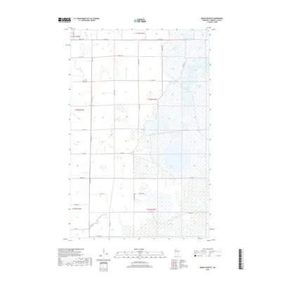
2019 Map of Middle River SE
USGS Topo · Published 2019About this map
Northwest Pool dominates the northeastern landscape of this Marshall County survey, illustrating the extensive wetland and drainage systems typical of the Red River Valley’s eastern edge. The topography is exceptionally level, defined primarily by a rigid grid of section-line roads and the winding course of the Thief River in the southwestern corner. Local travel and access to the marshy lowlands are facilitated by routes such as Co Hwy 7 and the NW Pool Rd, which skirts the edge of the large pool. Farther south, the Rodahl Trail provides a break from the standard township grid, hinting at older patterns of movement across the prairie. This 2019 data reflects a sparsely populated agricultural and conservation-focused region, where the intersection of drainage engineering and township boundaries, like t156n r42w, dictates the human footprint on the land.
Find a feature on this map
28 named features on this map. Tap any name to fly to it.
Don’t see what you’re looking for? This feature index may not catch every label — zoom into the map to look around manually.
Map Details
Editions of this 2019 Middle River SE Map
This is the sole edition of this map. No revisions or reprints were ever made.
Other maps of this area

1918 · Rollis
USGS Topo · 1:62,500

1918 · Middle River
USGS Topo · 1:62,500

1943 · Rollis
USGS Topo · 1:62,500

1943 · Thief River Falls
USGS Topo · 1:62,500

1952 · Thief River Falls
USGS Topo · 1:250,000

1954 · Roseau
USGS Topo · 1:250,000

1956 · Thief River Falls
USGS Topo · 1:250,000

1957 · Roseau
USGS Topo · 1:250,000

1957 · Thief River Falls
USGS Topo · 1:250,000

1958 · Roseau
USGS Topo · 1:250,000