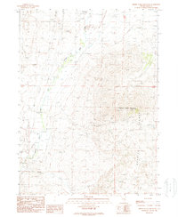
1989 Map of Middle Stack Mountain
USGS Topo · Published 1989About this map
Middle Stack Mountain dominates this high-desert landscape in Elko County, anchoring the northern reaches of the Granite Range. The map reveals a history of transit and extraction, notably marked by the Old Railroad Grade and sections of RR Grade that follow the winding course of Salmon Falls Creek. These remnants of early infrastructure, alongside an Abandoned Ditch, point to a past where water management and rail access were vital for the remote ranching and mining operations in this arid corridor.
Find a feature on this map
17 named features on this map. Tap any name to fly to it.
Don’t see what you’re looking for? This feature index may not catch every label — zoom into the map to look around manually.
Map Details
Editions of this 1989 Middle Stack Mountain Map
This is the sole edition of this map. No revisions or reprints were ever made.
Other maps of this area

1955 · Wells
USGS Topo · 1:250,000

1957 · Contact
USGS Topo · 1:62,500

1957 · Delaplain
USGS Topo · 1:62,500

1958 · Wells
USGS Topo · 1:250,000

1961 · Wells
USGS Topo · 1:250,000

1968 · Henry
USGS Topo · 1:24,000

1968 · Blanchard Mtn
USGS Topo · 1:24,000

1968 · Texas Spring
USGS Topo · 1:24,000

1982 · Jackpot
USGS Topo · 1:100,000
1989 · Jackpot
USGS Topo · 1:24,000