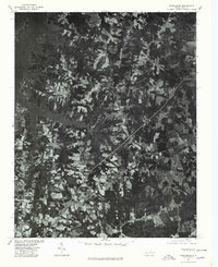
1977 Map of Middleburg
USGS Topo · Published 1978About this map
John H Kerr Reservoir dominates the northwestern corner of this quadrangle, its fingers reaching into a landscape of small agricultural clearings and dense woods. This 1977 orthophotoquad was produced by the U.S. Geological Survey in cooperation with the Soil Conservation Service, offering a literal photographic record of the terrain. The imagery highlights the distinct settlement patterns of the late 1970s, where clusters of homes and buildings congregate along the primary road and rail corridors. The unincorporated community of Drewry sits centrally, while Manson and Middleburg anchor the southeastern portion of the map. Unlike a standard topographic line map, this aerial survey reveals the exact textures of the North Carolina countryside, showing the relationship between working farmland, timber stands, and the major transportation routes that bisect the area.
Find a feature on this map
4 named features on this map. Tap any name to fly to it.
Don’t see what you’re looking for? This feature index may not catch every label — zoom into the map to look around manually.
Map Details
Editions of this 1977 Middleburg Map
This is the sole edition of this map. No revisions or reprints were ever made.
Other maps of this area

1953 · Greensboro
USGS Topo · 1:250,000

1954 · Greensboro
USGS Topo · 1:250,000

1955 · Boydton
USGS Topo · 1:62,500

1962 · Greensboro
USGS Topo · 1:250,000

1966 · Greensboro
USGS Topo · 1:250,000

1968 · Bracey
USGS Topo · 1:24,000
1968 · Tungsten
USGS Topo · 1:24,000

1968 · John H Kerr Dam
USGS Topo · 1:24,000

1970 · Vicksboro
USGS Topo · 1:24,000
1970 · Middleburg
USGS Topo · 1:24,000