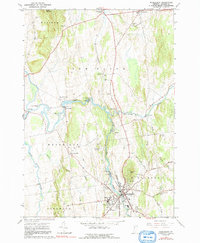
1963 Map of Middlebury
USGS Topo · Published 1991About this map
Middlebury serves as the focal point of this 1963 landscape, anchored by the campus of Middlebury College and the surrounding township. The area’s industrial and agricultural character is defined by the winding course of Otter Creek, which powers several sites including the Huntington Falls Dam and multiple power plants. The map details a sophisticated network of local roads such as Happy Valley Road and Painter Road, which connected the smaller settlements of Brooksville, Beldens, and Weybridge during this era.
Find a feature on this map
52 named features on this map. Tap any name to fly to it.
Don’t see what you’re looking for? This feature index may not catch every label — zoom into the map to look around manually.
Map Details
Editions of this 1963 Middlebury Map
3 editions found
Other maps of this area

1894 · Port Henry
USGS Topo · 1:62,500

1894 · Ticonderoga
USGS Topo · 1:62,500

1896 · Ticonderoga
USGS Topo · 1:62,500

1898 · Port Henry
USGS Topo · 1:62,500

1902 · Ticonderoga
USGS Topo · 1:62,500

1902 · Brandon
USGS Topo · 1:62,500

1903 · Middlebury
USGS Topo · 1:62,500

1904 · Brandon
USGS Topo · 1:62,500

1905 · Middlebury
USGS Topo · 1:62,500

1920 · Brandon
USGS Topo · 1:62,500