
Loading...
Loading map...1983 Map of Middleton
USGS Topo · Published 1984About this map
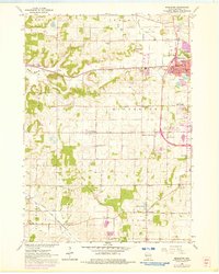
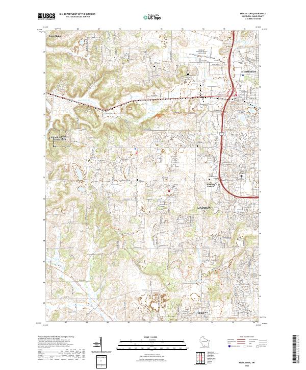
Middleton and the growing western edge of Madison anchor this 1983 survey, showing a landscape transitioning from the agricultural roots of Middleton Twp to modern residential and commercial expansion. The area is defined by its significant transportation corridors, including the Wisconsin Western and Chicago and North Western railroads, which historically shaped the development of local nodes like Middleton Junction.
Find a feature on this map
71 named features on this map. Tap any name to fly to it.
Don’t see what you’re looking for? This feature index may not catch every label — zoom into the map to look around manually.
Map Details
Date Portrayed1983
Date Published1984
PublisherU.S. Geological Survey
Map TypeTopographic
Scale1:24,000
Physical Dimensions21.58 x 27.17 inches
Editions of this 1983 Middleton Map
This is the sole edition of this map. No revisions or reprints were ever made.
Historical Maps of Madison Through Time
Featured Locations
Source Details
SourceU.S. Geological Survey
CopyrightPublic Domain