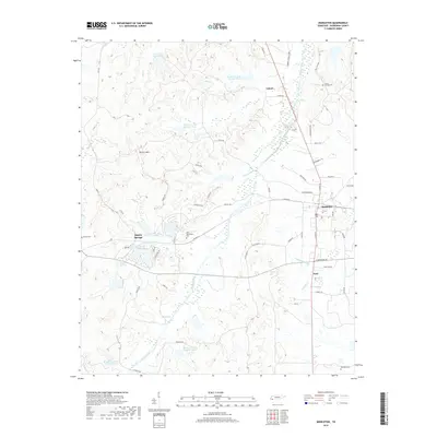
2019 Map of Middleton
USGS Topo · Published 2019About this map
Middleton serves as the primary hub of this Hardeman County landscape, situated at a junction of rail and road near Poor and the expansive wetlands of Cypress Cr. The terrain is defined by the winding course of Porters Creek, which feeds a series of numbered reservoirs including Porters Cr Lake Number Fifteen and Porters Cr Lake Number Four. To the northwest, the land rises toward Porters Mtn, while the settlement of Rogers Springs is tucked away near the western edge of the quadrangle. For genealogists and local historians, several burial sites are documented across the rural countryside, including Old Bethlehem Cem, Ramah Cem, and Sandy Springs Cem. The map also captures the agricultural character of the region, specifically noted at the Cub Cr Tree Farm Lake in the northern reaches.
Find a feature on this map
57 named features on this map. Tap any name to fly to it.
Don’t see what you’re looking for? This feature index may not catch every label — zoom into the map to look around manually.
Map Details
Editions of this 2019 Middleton Map
This is the sole edition of this map. No revisions or reprints were ever made.
Other maps of this area

1950 · Ashland
USGS Topo · 1:62,500

1950 · Pocahontas
USGS Topo · 1:24,000

1950 · Hebron
USGS Topo · 1:24,000

1950 · Hornsby
USGS Topo · 1:24,000

1950 · Middleburg
USGS Topo · 1:24,000

1950 · Middleton
USGS Topo · 1:24,000

1951 · Middleton
USGS Topo · 1:24,000

1951 · Middleburg
USGS Topo · 1:24,000

1951 · Hebron
USGS Topo · 1:24,000

1951 · Hornsby
USGS Topo · 1:24,000