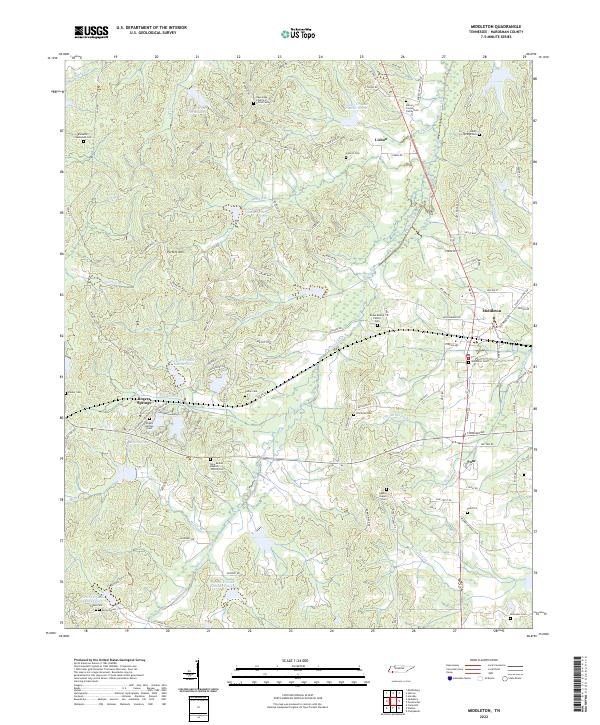
2022 Map of Middleton
USGS Topo · Published 2022About this map
Porters Creek and its many tributaries, including Thompson Cr and Cypress Cr, carve a complex drainage pattern across this Hardeman County landscape. The area is defined by small, named settlements such as Lisbon, Poor, and the more substantial town of Middleton. This 2022 survey reveals a land deeply rooted in its local history, evidenced by a dense concentration of family and community burial grounds. From the Macon Jordan Family Cem to the Old Enon Cem, these sites offer a significant trail for genealogical research. The terrain rises to Porters Mtn and Nibbin Ridge, while the hydrological system is punctuated by a numbered series of reservoirs, including Porters Cr Lake Number Six and Porters Cr Lake Number Fifteen. Rural life is centered around institutions like New Bethel Baptist Church, providing a clear view of the modern southern Tennessee backcountry.
Find a feature on this map
114 named features on this map. Tap any name to fly to it.
Don’t see what you’re looking for? This feature index may not catch every label — zoom into the map to look around manually.
Map Details
Editions of this 2022 Middleton Map
This is the sole edition of this map. No revisions or reprints were ever made.
Other maps of this area

1950 · Ashland
USGS Topo · 1:62,500

1950 · Pocahontas
USGS Topo · 1:24,000

1950 · Hebron
USGS Topo · 1:24,000

1950 · Hornsby
USGS Topo · 1:24,000

1950 · Middleburg
USGS Topo · 1:24,000

1950 · Middleton
USGS Topo · 1:24,000

1951 · Middleton
USGS Topo · 1:24,000

1951 · Middleburg
USGS Topo · 1:24,000

1951 · Hebron
USGS Topo · 1:24,000

1951 · Hornsby
USGS Topo · 1:24,000