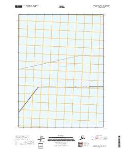
2018 Map of Middleton Island D-1 NE
USGS Topo · Published 2018About this map
The Gulf of Alaska dominates this maritime survey, illustrating the vast open waters south of the Alaskan coastline within the t22s r7e and t22s r8e townships. This 2018 edition reveals the primary maritime infrastructure of the region, notably a designated Ferry Route that traverses the northern half of the map. This charting reflects the essential role of waterborne transit for connecting the remote coastal reaches of the Valdez-Cordova Census Area. Unlike terrestrial maps filled with topographic relief, this maritime-focused sheet emphasizes the administrative and transit corridors established across the open sea.
Find a feature on this map
4 named features on this map. Tap any name to fly to it.
Don’t see what you’re looking for? This feature index may not catch every label — zoom into the map to look around manually.
Map Details
Editions of this 2018 Middleton Island D-1 NE Map
This is the sole edition of this map. No revisions or reprints were ever made.
Other maps of this area

1948 · Cordova
USGS Topo · 1:250,000

1948 · Middleton Island
USGS Topo · 1:250,000

1950 · Middleton Island
USGS Topo · 1:250,000

1950 · Bering Glacier
USGS Topo · 1:250,000

1950 · Icy Bay
USGS Topo · 1:250,000

1950 · Cordova A-1
USGS Topo · 1:63,360

1951 · Icy Bay
USGS Topo · 1:250,000

1951 · Bering Glacier
USGS Topo · 1:250,000

1951 · Cordova
USGS Topo · 1:250,000
1953 · Cordova A-1
USGS Topo · 1:63,360