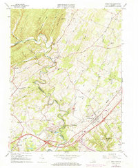
1966 Map of Middletown
USGS Topo · Published 1973About this map
Cedar Creek carves a winding path through the heart of this Shenandoah Valley landscape, serving as a prominent natural and political boundary between Frederick and Shenandoah counties. Near the town of Middletown, the presence of the Cedar Creek Battlefield and Cedar Creek Wayside ground the map in the region's deep Civil War heritage. The map documents a blend of educational and community landmarks, from the campus of Monroe College to numerous country churches like Hites Chapel and Lebanon Church.
Find a feature on this map
65 named features on this map. Tap any name to fly to it.
Don’t see what you’re looking for? This feature index may not catch every label — zoom into the map to look around manually.
Map Details
Editions of this 1966 Middletown Map
3 editions found
Other maps of this area

1893 · Luray
USGS Topo · 1:125,000

1894 · Winchester
USGS Topo · 1:125,000

1905 · Luray
USGS Topo · 1:125,000

1923 · Middletown
USGS Topo · 1:62,500

1937 · Middletown
USGS Topo · 1:48,000

1938 · Winchester
USGS Topo · 1:48,000

1939 · Front Royal
USGS Topo · 1:48,000

1942 · Winchester
USGS Topo · 1:62,500

1943 · Middletown
USGS Topo · 1:62,500

1944 · Front Royal
USGS Topo · 1:62,500