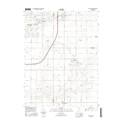
2016 Map of Middletown
USGS Topo · Published 2016About this map
Middletown serves as a central hub on this Indiana landscape, situated where the borders of Madison, Delaware, and Henry Counties converge. This 2016 survey illustrates the established agricultural and residential patterns of the region, anchored by the White River in the northwest and Fall Creek flowing through the southern portion. The area is dense with family-named landmarks and local burial grounds, such as Bronnenberg Cem and Keesling Cem, providing essential points of reference for genealogists tracing local lineage.
Find a feature on this map
138 named features on this map. Tap any name to fly to it.
Don’t see what you’re looking for? This feature index may not catch every label — zoom into the map to look around manually.
Map Details
Editions of this 2016 Middletown Map
This is the sole edition of this map. No revisions or reprints were ever made.
Other maps of this area

1949 · New Castle West
USGS Topo · 1:24,000

1952 · Muncie West
USGS Topo · 1:24,000

1952 · Anderson
USGS Topo · 1:24,000

1953 · Pendleton
USGS Topo · 1:24,000

1953 · Cincinnati
USGS Topo · 1:250,000

1953 · Muncie
USGS Topo · 1:250,000

1956 · Muncie
USGS Topo · 1:250,000

1957 · Cincinnati
USGS Topo · 1:250,000

1960 · Gilman
USGS Topo · 1:24,000

1960 · New Castle West
USGS Topo · 1:24,000