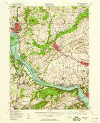
1956 Map of Middletown
USGS Topo · Published 1959About this map
Olmsted AFB and the industrial activity of the mid-20th century define this stretch of the Susquehanna River, where the borders of Dauphin, York, and Lancaster counties meet. The river landscape is characterized by a dense network of islands, including the prominent Threemile Island, and the complex hydrography of the Haldeman Riffles near Bainbridge. While the riverside supports centers like Middletown, Marietta, and Wrightsville, the interior transitions into a grid of rural schools and historic congregations such as Shope Ch and Bosslers Ch.
Find a feature on this map
152 named features on this map. Tap any name to fly to it.
Don’t see what you’re looking for? This feature index may not catch every label — zoom into the map to look around manually.
Map Details
Editions of this 1956 Middletown Map
2 editions found
Other maps of this area

1891 · Lebanon
USGS Topo · 1:62,500

1892 · Hummelstown
USGS Topo · 1:62,500

1892 · Harrisburg
USGS Topo · 1:62,500

1893 · Lebanon
USGS Topo · 1:62,500

1899 · Lebanon
USGS Topo · 1:62,500

1899 · Harrisburg
USGS Topo · 1:62,500

1902 · Lancaster
USGS Topo · 1:62,500

1904 · Lancaster
USGS Topo · 1:62,500

1906 · New Cumberland
USGS Topo · 1:62,500

1908 · Middletown
USGS Topo · 1:62,500