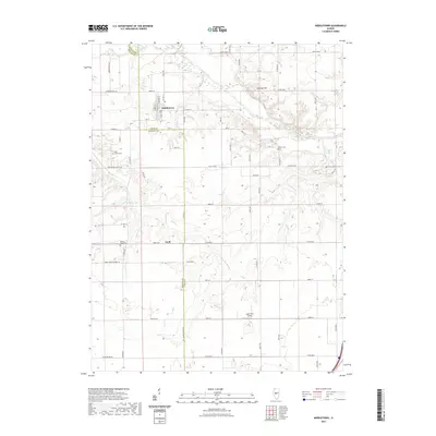
2021 Map of Middletown
USGS Topo · Published 2021About this map
Middletown serves as the primary hub of this Central Illinois landscape, where the convergence of Logan Co and Menard Co lines defines the local geography. The area's agricultural character is evidenced by a dense network of country roads, including the aptly named Honey Heart School Rd and Irish Grove Church Ave, which hint at earlier rural community centers. Along the northern reaches, Salt Creek winds past Polecat Hill, providing a distinct break in the otherwise steady terrain. For genealogists, the map is particularly valuable for its documentation of local burial grounds, such as Irish Grove Cem and Walnut Ridge Cem. Further south, the small settlement of Croft and the Leigh Farm Airport represent later developments in a region that continues to be shaped by the drainages of Pike Cr and McMann Lake.
Find a feature on this map
43 named features on this map. Tap any name to fly to it.
Don’t see what you’re looking for? This feature index may not catch every label — zoom into the map to look around manually.
Map Details
Editions of this 2021 Middletown Map
This is the sole edition of this map. No revisions or reprints were ever made.
Other maps of this area

1907 · Springfield
USGS Topo · 1:62,500

1911 · Lincoln
USGS Topo · 1:62,500

1913 · Lincoln
USGS Topo · 1:62,500

1930 · Springfield
USGS Topo · 1:62,500

1940 · Springfield
USGS Topo · 1:62,500

1948 · Mason City
USGS Topo · 1:62,500

1949 · Mason City
USGS Topo · 1:62,500

1954 · Mechanicsburg
USGS Topo · 1:62,500

1958 · Peoria
USGS Topo · 1:250,000

1958 · Decatur
USGS Topo · 1:250,000