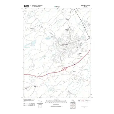
2010 Map of Middletown
USGS Topo · Published 2010About this map
Middletown serves as the primary urban hub on this 2010 topographic survey, surrounded by established neighborhoods and agricultural operations in Orange County. The landscape reflects a mixture of historic land use and modern infrastructure, featuring the Orange County Fairgrounds and Orange County Fair Speedway as prominent landmarks. Agricultural history remains visible through Soons Orchards and Horton Dairy, while several graveyards, including Saint Joseph Cemetery and Hillside Cemetery, provide vital points of interest for genealogists. To the south and west, the terrain rises toward Mills Hill and Sayers Hill, with the waters of Highland Lake and Lake Pocatello punctuating the landscape. The transportation network is defined by major corridors and smaller local landmarks like Crawford Junction, illustrating the area's role as a regional connector between smaller settlements like New Hampton and Slate Hill.
Find a feature on this map
110 named features on this map. Tap any name to fly to it.
Don’t see what you’re looking for? This feature index may not catch every label — zoom into the map to look around manually.
Map Details
Editions of this 2010 Middletown Map
This is the sole edition of this map. No revisions or reprints were ever made.
Other maps of this area

1904 · Ellenville
USGS Topo · 1:62,500

1906 · Ellenville
USGS Topo · 1:62,500

1906 · Port Jervis
USGS Topo · 1:62,500

1906 · Goshen
USGS Topo · 1:62,500

1908 · Goshen
USGS Topo · 1:62,500

1908 · Port Jervis
USGS Topo · 1:62,500

1909 · Monticello
USGS Topo · 1:62,500

1911 · Monticello
USGS Topo · 1:62,500

1938 · Goshen
USGS Topo · 1:62,500

1942 · Pine Island
USGS Topo · 1:24,000