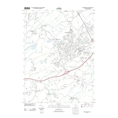
2013 Map of Middletown
USGS Topo · Published 2013About this map
The Orange County Fairgrounds and the adjacent Orange County Fair Speedway anchor the eastern landscape of this New York region, illustrating a legacy of regional entertainment and competition. The area is defined by its transition from the urban density of East Middletown and Washington Heights into the agricultural and institutional lands to the south and west. Significant landmarks include the Mid Hudson Psychiatric Ctr and the Middletown & New Jersey RR, which corridors through several small hamlets.
Find a feature on this map
282 named features on this map. Tap any name to fly to it.
Don’t see what you’re looking for? This feature index may not catch every label — zoom into the map to look around manually.
Map Details
Editions of this 2013 Middletown Map
This is the sole edition of this map. No revisions or reprints were ever made.
Other maps of this area

1904 · Ellenville
USGS Topo · 1:62,500

1906 · Ellenville
USGS Topo · 1:62,500

1906 · Port Jervis
USGS Topo · 1:62,500

1906 · Goshen
USGS Topo · 1:62,500

1908 · Goshen
USGS Topo · 1:62,500

1908 · Port Jervis
USGS Topo · 1:62,500

1909 · Monticello
USGS Topo · 1:62,500

1911 · Monticello
USGS Topo · 1:62,500

1938 · Goshen
USGS Topo · 1:62,500

1942 · Pine Island
USGS Topo · 1:24,000