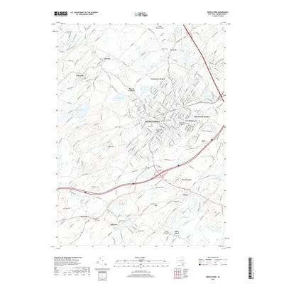
2019 Map of Middletown
USGS Topo · Published 2019About this map
Middletown and its surrounding hamlets are captured here at a moment of significant educational and residential density in eastern Orange County. The presence of both the Orange County Community College and the Touro College of Osteopathic Medicine Middletown underscores the area's development as a regional hub. Beyond the urban center, the landscape is defined by its water and high ground, from the Wallkill River in the southeast to Highland Lake and the peak of Sayers Hill in the west. Genealogists and local historians will find value in the cluster of burial grounds, including the Old School Baptist Church Cem in Ridgebury and the Saint Joseph Cem near Mechanicstown. Transportation routes remain vital, with the Norfolk Southern rail line and Randall Airport serving as key connectors for this Hudson Valley community.
Find a feature on this map
246 named features on this map. Tap any name to fly to it.
Don’t see what you’re looking for? This feature index may not catch every label — zoom into the map to look around manually.
Map Details
Editions of this 2019 Middletown Map
This is the sole edition of this map. No revisions or reprints were ever made.
Other maps of this area

1904 · Ellenville
USGS Topo · 1:62,500

1906 · Ellenville
USGS Topo · 1:62,500

1906 · Port Jervis
USGS Topo · 1:62,500

1906 · Goshen
USGS Topo · 1:62,500

1908 · Goshen
USGS Topo · 1:62,500

1908 · Port Jervis
USGS Topo · 1:62,500

1909 · Monticello
USGS Topo · 1:62,500

1911 · Monticello
USGS Topo · 1:62,500

1938 · Goshen
USGS Topo · 1:62,500

1942 · Pine Island
USGS Topo · 1:24,000