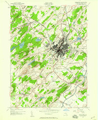
1942 Map of Middletown
USGS Topo · Published 1959About this map
Middletown serves as the central hub of this mid-century Orange County landscape, where the dense grid of the city meets the radiating transport lines of the Erie railroad and the New York And Western line. The map illustrates a period of significant institutional growth, anchored by large complexes such as the State Hospital and Horton Hospital, alongside educational centers like St Alberts College. Surrounding the urban core, smaller communities such as Howells, Mechanicstown, and New Hampton maintain their distinct identities amidst a transition toward more suburban developments.
Find a feature on this map
42 named features on this map. Tap any name to fly to it.
Don’t see what you’re looking for? This feature index may not catch every label — zoom into the map to look around manually.
Map Details
Editions of this 1942 Middletown Map
This is the sole edition of this map. No revisions or reprints were ever made.
Other maps of this area

1904 · Ellenville
USGS Topo · 1:62,500

1906 · Ellenville
USGS Topo · 1:62,500

1906 · Port Jervis
USGS Topo · 1:62,500

1906 · Goshen
USGS Topo · 1:62,500

1908 · Goshen
USGS Topo · 1:62,500

1908 · Port Jervis
USGS Topo · 1:62,500

1909 · Monticello
USGS Topo · 1:62,500

1911 · Monticello
USGS Topo · 1:62,500

1938 · Goshen
USGS Topo · 1:62,500

1942 · Pine Island
USGS Topo · 1:24,000