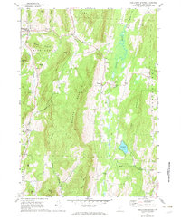
1967 Map of Middletown Springs
USGS Topo · Published 1972About this map
Middletown Springs and the surrounding Taconic foothills appear here in a snapshot of late-1960s rural Vermont. The landscape is defined by the steep north-south ridges of Tinmouth Mountain and Clark Mountain, which funnel the Tinmouth Channel and various brooks toward the Poultney River. Significant local industry is represented by numerous Gravel Pits scattered along the valley floor, while the cultural history of the area is preserved in a high density of small family or community burial grounds, including the Pleasant View Cem and Crampton Cem.
Find a feature on this map
41 named features on this map. Tap any name to fly to it.
Don’t see what you’re looking for? This feature index may not catch every label — zoom into the map to look around manually.
Map Details
Editions of this 1967 Middletown Springs Map
3 editions found
Other maps of this area

1891 · Rutland
USGS Topo · 1:62,500

1893 · Wallingford
USGS Topo · 1:62,500

1893 · Rutland
USGS Topo · 1:62,500

1894 · Pawlet
USGS Topo · 1:62,500

1895 · Castleton
USGS Topo · 1:62,500

1897 · Pawlet
USGS Topo · 1:62,500

1897 · Castleton
USGS Topo · 1:62,500

1903 · Mettawee
USGS Topo · 1:125,000

1950 · Glens Falls
USGS Topo · 1:250,000

1955 · Wallingford
USGS Topo · 1:62,500