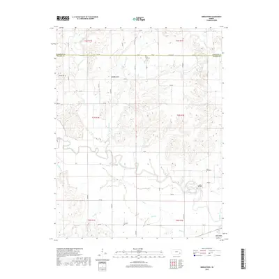
2018 Map of Middletown
USGS Topo · Published 2018About this map
The Verdigris River meanders through this portion of southeast Kansas, marking the transition between the agricultural uplands and the river valley. The landscape is defined by its drainage network, with Sandy Creek, Walnut Cr, and Snake Cr feeding into the main river channel. Settlements like Middletown and Benedict anchor the local road grid, which follows section lines across the Wilson and Woodson county border. For those researching local history, several family-named and community landmarks are clearly visible, including Leeper Bridge and Moss Bridge crossing the river. The distribution of rural burial grounds, such as Little Sandy Cem, Farmington Cem, and Maple Grove Cem, provides a map of early settlement patterns and family heritage in this prairie region.
Find a feature on this map
50 named features on this map. Tap any name to fly to it.
Don’t see what you’re looking for? This feature index may not catch every label — zoom into the map to look around manually.
Map Details
Editions of this 2018 Middletown Map
This is the sole edition of this map. No revisions or reprints were ever made.
Other maps of this area

1886 · Fredonia
USGS Topo · 1:125,000

1894 · Fredonia
USGS Topo · 1:125,000

1938 · Fredonia
USGS Topo · 1:62,500

1938 · Altoona
USGS Topo · 1:62,500

1939 · Altoona
USGS Topo · 1:48,000

1939 · Fredonia
USGS Topo · 1:48,000

1942 · Fredonia
USGS Topo · 1:62,500

1943 · Fredonia
USGS Topo · 1:62,500

1943 · Altoona
USGS Topo · 1:62,500

1947 · Joplin
USGS Topo · 1:250,000