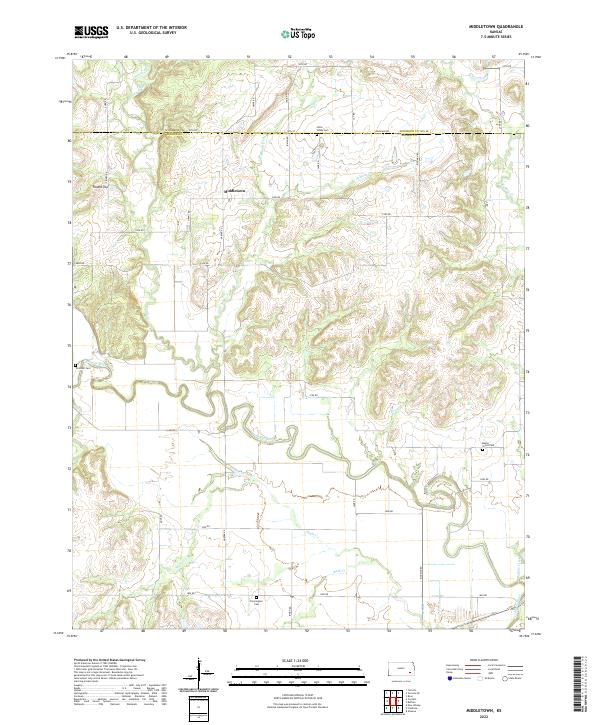
2022 Map of Middletown
USGS Topo · Published 2022About this map
Middletown serves as the central point in this prairie landscape, where the Woodson Co Wilson Co line marks a significant administrative boundary. The geography is defined by the winding course of the Verdigris River, which meanders through the southern half of the map, creating a distinct floodplain that contrasts with the surrounding uplands. Local drainage is managed by numerous smaller waterways, including Sandy Creek, Walnut Cr, and Snake Cr, which carve subtle relief into the terrain. Notable landmarks for genealogical research include Little Sandy Cem, Trimmell Cem, Maple Grove Cem, and Farmington Cem, which are scattered throughout the rural sections. The township and range system, including t27s r14e, provides the framework for the modern road network, where routes like Grant Rd and Indian Rd follow the section lines across this agricultural region.
Find a feature on this map
44 named features on this map. Tap any name to fly to it.
Don’t see what you’re looking for? This feature index may not catch every label — zoom into the map to look around manually.
Map Details
Editions of this 2022 Middletown Map
This is the sole edition of this map. No revisions or reprints were ever made.
Other maps of this area

1886 · Fredonia
USGS Topo · 1:125,000

1894 · Fredonia
USGS Topo · 1:125,000

1938 · Fredonia
USGS Topo · 1:62,500

1938 · Altoona
USGS Topo · 1:62,500

1939 · Altoona
USGS Topo · 1:48,000

1939 · Fredonia
USGS Topo · 1:48,000

1942 · Fredonia
USGS Topo · 1:62,500

1943 · Fredonia
USGS Topo · 1:62,500

1943 · Altoona
USGS Topo · 1:62,500

1947 · Joplin
USGS Topo · 1:250,000