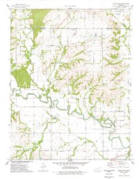
1975 Map of Middletown
USGS Topo · Published 1978About this map
The Verdigris River carves a winding path through the heart of the Kansas prairie, defining the borders between rural townships like Belmont, Webster, and Clifton. This mid-1970s landscape is characterized by its agricultural geometry, interrupted only by the deep meanders of the river and its many tributaries, including Little Sandy Creek and Walnut Creek. In the center of this network lies Middletown, a small settlement served by landmark crossings such as Moss Bridge and Leeper Bridge.
Find a feature on this map
28 named features on this map. Tap any name to fly to it.
Don’t see what you’re looking for? This feature index may not catch every label — zoom into the map to look around manually.
Map Details
Editions of this 1975 Middletown Map
This is the sole edition of this map. No revisions or reprints were ever made.
Other maps of this area

1886 · Fredonia
USGS Topo · 1:125,000

1894 · Fredonia
USGS Topo · 1:125,000

1938 · Fredonia
USGS Topo · 1:62,500

1938 · Altoona
USGS Topo · 1:62,500

1939 · Altoona
USGS Topo · 1:48,000

1939 · Fredonia
USGS Topo · 1:48,000

1942 · Fredonia
USGS Topo · 1:62,500

1943 · Fredonia
USGS Topo · 1:62,500

1943 · Altoona
USGS Topo · 1:62,500

1947 · Joplin
USGS Topo · 1:250,000