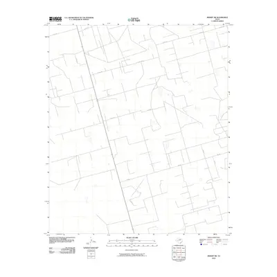
2010 Map of Midkiff SW
USGS Topo · Published 2010About this map
Upton County, Texas, reveals a landscape dominated by a precise network of industrial and rural access roads in this 2010 survey. The terrain is defined by a grid-like infrastructure of county roads, most notably Farm to Market Road 2401 crossing the lower section and County Road 116 slicing through the center. Small depressions and catchments are scattered throughout the quadrangle, typical of the Permian Basin's arid environment. The map details an area primarily used for energy extraction and ranching, where routes like County Road 118 W and County Road 118 E provide the essential framework for navigating this high-plains geography. This survey provides a baseline for tracking modern land use and road development in a region where local names like Road 125 and County Road 114 serve as the primary landmarks.
Find a feature on this map
10 named features on this map. Tap any name to fly to it.
Don’t see what you’re looking for? This feature index may not catch every label — zoom into the map to look around manually.
Map Details
Editions of this 2010 Midkiff SW Map
This is the sole edition of this map. No revisions or reprints were ever made.
Other maps of this area

1928 · Crane
USGS Topo · 1:125,000

1928 · Rankin
USGS Topo · 1:125,000

1954 · Pecos
USGS Topo · 1:250,000

1954 · San Angelo
USGS Topo · 1:250,000

1957 · Pecos
USGS Topo · 1:250,000

1958 · San Angelo
USGS Topo · 1:250,000

1965 · San Angelo
USGS Topo · 1:250,000

1967 · Midkiff
USGS Topo · 1:24,000

1968 · Benge Corner SE
USGS Topo · 1:24,000

1968 · Midkiff NW
USGS Topo · 1:24,000