
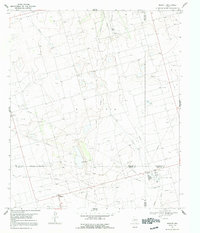
1967 Map of Midkiff
USGS Topo · Published 1970About this map
Industrial infrastructure dominates this West Texas landscape where the boundaries of Midland, Glasscock, Upton, and Reagan counties converge. The 1960s economy is defined by a dense network of Oil Wells, a central Oil Field, and extensive Pipelines cutting across the terrain. At the southern edge of the survey, the settlement of Midkiff and the nearby Midkiff Camp serve as local hubs for the energy sector. Evidence of specialized utility work is visible in the presence of the Midkiff Gas Plant, another smaller Gas Plant, and a massive Aqueduct system. Transport and communication are represented by a local Landing Strip and a Radio Tower, while numerous Gravel Pits suggest ongoing construction and road maintenance during this period of mid-century expansion.
Find a feature on this map
19 named features on this map. Tap any name to fly to it.
Don’t see what you’re looking for? This feature index may not catch every label — zoom into the map to look around manually.
Map Details
Editions of this 1967 Midkiff Map
2 editions found
Other maps of this area

1954 · San Angelo
USGS Topo · 1:250,000

1958 · San Angelo
USGS Topo · 1:250,000

1965 · San Angelo
USGS Topo · 1:250,000

1965 · Salt Lake
USGS Topo · 1:24,000

1965 · Pecks Lake
USGS Topo · 1:24,000

1965 · Patterson Lake
USGS Topo · 1:24,000

1968 · Midkiff NW
USGS Topo · 1:24,000

1968 · Midkiff SW
USGS Topo · 1:24,000

1968 · Midkiff SE
USGS Topo · 1:24,000

1973 · Bigby Corner
USGS Topo · 1:24,000