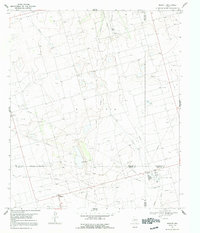
1967 Map of Midkiff
USGS Topo · Published 1991About this map
Midland County oil and gas infrastructure dominates this Permian Basin landscape during the late 1960s. The map captures a moment of intense industrial activity centered around the community of Midkiff, where a sprawling network of pipelines and service roads connects various extraction points. Industrial landmarks like the Midkiff Gas Plant and a smaller gas plant to the north signal the scale of production in this sector. Transportation needs for this industrial hub are reflected in the presence of a Landing Strip and the Midkiff Camp worker settlement. Grounded in the 1967 topography, the map reveals the intersection of several county boundaries, including the Midland Co and Upton Co lines, which cut through the oil fields and grazing lands of West Texas.
Find a feature on this map
6 named features on this map. Tap any name to fly to it.
Don’t see what you’re looking for? This feature index may not catch every label — zoom into the map to look around manually.
Map Details
Editions of this 1967 Midkiff Map
2 editions found
Other maps of this area

1954 · San Angelo
USGS Topo · 1:250,000

1958 · San Angelo
USGS Topo · 1:250,000

1965 · San Angelo
USGS Topo · 1:250,000

1965 · Salt Lake
USGS Topo · 1:24,000

1965 · Pecks Lake
USGS Topo · 1:24,000

1965 · Patterson Lake
USGS Topo · 1:24,000

1967 · Midkiff
USGS Topo · 1:24,000

1968 · Midkiff NW
USGS Topo · 1:24,000

1968 · Midkiff SW
USGS Topo · 1:24,000

1968 · Midkiff SE
USGS Topo · 1:24,000