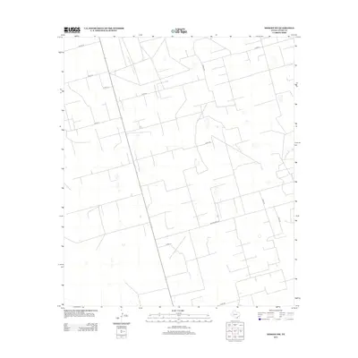
2012 Map of Midkiff SW
USGS Topo · Published 2012About this map
Ranch Road 2401 cuts through the arid landscape of Upton County, defining the primary east-west transit corridor for this part of West Texas. This 2012 survey reveals a highly organized grid of rural infrastructure, where service routes like Cotton Ln and Road 119 connect vast tracts of land typically associated with the region's energy and ranching sectors. The geometric precision of the road network, including Co Rd-118W and Co Rd-116, reflects a landscape partitioned for utility, with numerous small impoundments or tanks scattered across the terrain to support local operations. This detailed layout serves as a record of the modern working landscape in the Permian Basin, showing the intersection of state-maintained thoroughfares and the local gravel roads that sustain the area's industrial and agricultural output.
Find a feature on this map
13 named features on this map. Tap any name to fly to it.
Don’t see what you’re looking for? This feature index may not catch every label — zoom into the map to look around manually.
Map Details
Editions of this 2012 Midkiff SW Map
This is the sole edition of this map. No revisions or reprints were ever made.
Other maps of this area

1928 · Crane
USGS Topo · 1:125,000

1928 · Rankin
USGS Topo · 1:125,000

1954 · Pecos
USGS Topo · 1:250,000

1954 · San Angelo
USGS Topo · 1:250,000

1957 · Pecos
USGS Topo · 1:250,000

1958 · San Angelo
USGS Topo · 1:250,000

1965 · San Angelo
USGS Topo · 1:250,000

1967 · Midkiff
USGS Topo · 1:24,000

1968 · Benge Corner SE
USGS Topo · 1:24,000

1968 · Midkiff NW
USGS Topo · 1:24,000