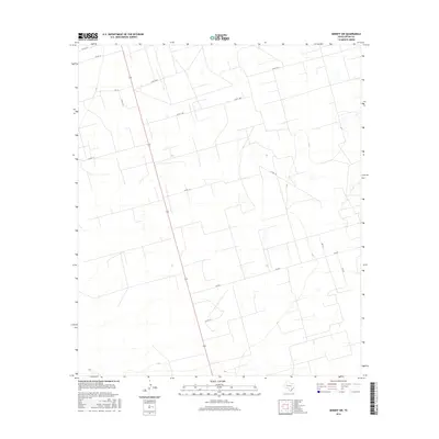
2016 Map of Midkiff SW
USGS Topo · Published 2016About this map
Upton County ranchlands and agricultural fields define this portion of the Permian Basin, where a precise grid of rural routes facilitates movement through the expansive terrain. The most prominent corridor is Fm 2401, which cuts east-to-west across the lower half of the landscape. This network of unpaved and secondary roads, such as Co Rd 116 and Co Rd 114, reflects the region's long-standing reliance on livestock and oil field access. The map reveals the intricate land partitions characteristic of West Texas, with family and service roads like Cotton Ln and Co Rd 120-A leading to remote homesteads or work sites. The sparse water features and regular intervals of the survey grid illustrate a landscape managed for resource extraction and ranching in the twenty-first century.
Find a feature on this map
13 named features on this map. Tap any name to fly to it.
Don’t see what you’re looking for? This feature index may not catch every label — zoom into the map to look around manually.
Map Details
Editions of this 2016 Midkiff SW Map
This is the sole edition of this map. No revisions or reprints were ever made.
Other maps of this area

1928 · Crane
USGS Topo · 1:125,000

1928 · Rankin
USGS Topo · 1:125,000

1954 · Pecos
USGS Topo · 1:250,000

1954 · San Angelo
USGS Topo · 1:250,000

1957 · Pecos
USGS Topo · 1:250,000

1958 · San Angelo
USGS Topo · 1:250,000

1965 · San Angelo
USGS Topo · 1:250,000

1967 · Midkiff
USGS Topo · 1:24,000

1968 · Benge Corner SE
USGS Topo · 1:24,000

1968 · Midkiff NW
USGS Topo · 1:24,000