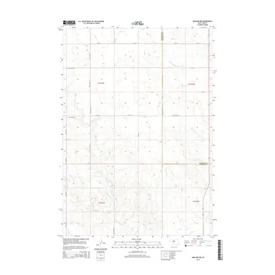
2015 Map of Midland NW
USGS Topo · Published 2015About this map
Ottumwa School Rd anchors the northern portion of this South Dakota landscape, providing a trace of local education history in an area defined by wide-reaching drainage networks and township divisions. The terrain is characterized by the intricate branching of several watercourses, including Little Prairie Dog Cr, Burnt Cr, and Mitchell Cr, which cut through the high plains toward the Lone Tree Cr basin in the southeast. Roads often follow these natural contours or strict section lines, with Saddle Butte Rd and Burnt Creek Rd serving as primary connectors across the rural expanse. The map highlights the intersection of Haakon and Stanley counties, where the surveyor's grid remains the dominant organizing principle for the ranches and homesteads that rely on these intermittent seasonal creeks.
Find a feature on this map
23 named features on this map. Tap any name to fly to it.
Don’t see what you’re looking for? This feature index may not catch every label — zoom into the map to look around manually.
Map Details
Editions of this 2015 Midland NW Map
This is the sole edition of this map. No revisions or reprints were ever made.
Other maps of this area

1954 · Midland
USGS Topo · 1:24,000

1954 · Nowlin
USGS Topo · 1:24,000

1954 · Midland SE
USGS Topo · 1:24,000

1954 · Pierre
USGS Topo · 1:250,000

1958 · Pierre
USGS Topo · 1:250,000

1982 · Hayes South
USGS Topo · 1:24,000
1982 · Midland NE
USGS Topo · 1:24,000

1982 · Midland NW
USGS Topo · 1:24,000

1982 · May Ranch
USGS Topo · 1:24,000

1983 · Philip
USGS Topo · 1:100,000