
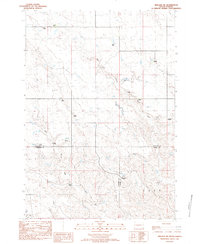
1982 Map of Hayes South
USGS Topo · Published 1983About this map
Ranching operations define the remote prairie landscape of Stanley County in the early 1980s, centered around the small hub of Hayes. This topographic record reveals a network of family-held lands such as the Norman Ranch, Hannum Ranch, and Cloverdale Ranch connected by unpaved roads and rural routes like Highway 34. Cultural life is anchored by the Little Brown Ch and Grace Ch, while the Hayes Airport and a nearby Historical Marker denote the area's significance in regional transit and local memory.
Find a feature on this map
33 named features on this map. Tap any name to fly to it.
Don’t see what you’re looking for? This feature index may not catch every label — zoom into the map to look around manually.
Map Details
Editions of this 1982 Hayes South Map
This is the sole edition of this map. No revisions or reprints were ever made.
Other maps of this area

1951 · Capa NW
USGS Topo · 1:24,000

1954 · Pierre
USGS Topo · 1:250,000

1958 · Pierre
USGS Topo · 1:250,000

1980 · Princes Ranch
USGS Topo · 1:25,000

1982 · Hohrman Ranch
USGS Topo · 1:24,000
1982 · Midland NE
USGS Topo · 1:24,000

1982 · Midland NW
USGS Topo · 1:24,000

1982 · May Ranch
USGS Topo · 1:24,000

1983 · Bentley Ranch
USGS Topo · 1:24,000

1983 · Hayes North
USGS Topo · 1:24,000