
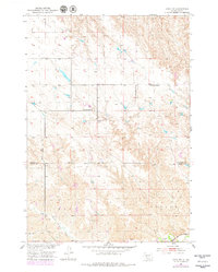
1951 Map of Capa NW
USGS Topo · Published 1953About this map
The B O V I N E landscape along the border of Stanley and Jones Counties is documented here during the early 1950s. This region of South Dakota is defined by the drainage of the Bad River and its tributary, Prairie Dog Creek, which carve through the terrain in the southern portion of the map. The spatial arrangement of community life is visible through isolated rural institutions such as the Twin Butte School and Rolling Green Sch, which served the scattered agricultural population of the era.
Find a feature on this map
8 named features on this map. Tap any name to fly to it.
Don’t see what you’re looking for? This feature index may not catch every label — zoom into the map to look around manually.
Map Details
Editions of this 1951 Capa NW Map
2 editions found
Other maps of this area

1951 · Capa
USGS Topo · 1:24,000

1951 · Van Metre
USGS Topo · 1:24,000

1951 · Capa SE
USGS Topo · 1:24,000

1954 · Midland SE
USGS Topo · 1:24,000

1954 · Pierre
USGS Topo · 1:250,000

1958 · Pierre
USGS Topo · 1:250,000
1982 · Doty Ridge
USGS Topo · 1:24,000

1982 · Hayes South
USGS Topo · 1:24,000

1982 · Hohrman Ranch
USGS Topo · 1:24,000
1982 · Midland NE
USGS Topo · 1:24,000