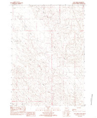
1982 Map of Doty Ridge
USGS Topo · Published 1983About this map
Doty Ridge defines the central spine of this Stanley County landscape, a prominent landform that dictates the drainage patterns of the surrounding prairie. This 1982 provisional survey reveals a remote section of South Dakota where the terrain is carved by the intermittent flows of Lance Creek and Brush Creek. The map documents a sparsely populated ranching territory characterized by its topographical detail rather than its infrastructure. The southern edge is defined by Plum Cr, while the grid lines of Township 4 North and Township 5 North suggest the vast, open nature of the regional land management during this era. This survey is particularly useful for those studying the physical geography and hydrology of the Missouri River plateau prior to more modern development.
Find a feature on this map
7 named features on this map. Tap any name to fly to it.
Don’t see what you’re looking for? This feature index may not catch every label — zoom into the map to look around manually.
Map Details
Editions of this 1982 Doty Ridge Map
This is the sole edition of this map. No revisions or reprints were ever made.
Other maps of this area

1937 · Oahe
USGS Topo · 1:62,500

1951 · Van Metre
USGS Topo · 1:24,000

1951 · Capa NW
USGS Topo · 1:24,000

1953 · Oahe SW
USGS Topo · 1:24,000

1953 · Wendte
USGS Topo · 1:24,000

1954 · Pierre
USGS Topo · 1:250,000

1958 · Pierre
USGS Topo · 1:250,000

1980 · Princes Ranch
USGS Topo · 1:25,000
1982 · Lacy
USGS Topo · 1:24,000

1982 · Hohrman Ranch
USGS Topo · 1:24,000